Choquequirao
9 Day / 8 Night Tour
- 9 days / 8 nights
- Max Group Size: 8
- Starts in Cusco
- Book all year round
- Regular & luxury tents available
- Ends in Machu Picchu
Introduction
The Choquequirao to Machu Picchu circuit follows a remote Inca trail that was a crucial thoroughfare during the Inca era, connecting the Chinchaysuyo region in the northwest of the Tawantinsuyo empire to the Antisuyo. Choquequirao, an ancient citadel along this route, served as a strategic checkpoint that grew in significance over time, becoming a prominent political and administrative center. While it may have held less religious importance compared to Machu Picchu, Choquequirao remains captivating with its rugged terrain nestled in the sub-tropical ecological zone of the jungle brow.
Highlights
Max Altitude
Distance
Duration
Average daily hike
Add Your Heading Text Here
Book Now
Searching Availability...
Itinerary
Embark on an unforgettable 9-day trek through the heart of the Peruvian Andes on the Choquequirao Machu Picchu Trail. Starting from Cusco, the journey begins with a scenic drive to Cachora, where trekking commences towards Chiquiska, offering stunning views of the Apurímac River valley. Over the following days, hikers traverse rugged terrain, ancient Inca trails, and cloud forests, visiting the awe-inspiring Choquequirao archaeological site and lesser-known ruins like Pinchaunuyoc. The trek ascends through diverse ecosystems, from the lush Victoria River to the high-altitude passes of Yanama and Totora, showcasing panoramic vistas of snow-capped peaks and valleys.
After descending to the hydroelectric plant, the trail culminates with a visit to the legendary Machu Picchu. Exploring the iconic citadel’s terraces, temples, and sunlit plazas, trekkers absorb its historical significance as a center of Inca culture. The adventure concludes with a return journey through Ollantaytambo, offering a rich tapestry of natural beauty, archaeological wonders, and cultural immersion in the heart of the Andes.
Our adventure to Choquequirao begins early in the morning with a pickup from your hotel in a private vehicle, heading to the town of San Pedro de Cachora, a journey of about 4 hours.We rise early, preparing for the day ahead with a simple breakfast. Boarding the bus, we begin our journey, winding through the Andean landscape for about 2 and a half hours until we reach Curahuasi, sitting at 2600 meters above sea level. Continuing on for another hour, we arrive at Cachora, a picturesque town at 2700 meters. After a brief stop, we venture onwards for 30 minutes more to Capuliyoq, our starting point where we meet the muleteers and their mules.
With introductions exchanged and supplies loaded, we set off on foot towards our first camp, Chiquisca, situated in the shadow of the Padreyoc mountain. The trail offers glimpses of the Apurimac Canyon as we descend gradually, the terrain mostly downhill. As we walk, the rugged beauty of the landscape unfolds around us, creating a sense of connection to the natural world.
Arriving at our campsite, tired but satisfied, we gather under the evening sky. As darkness falls, we share stories and laughter, enjoying the simple pleasure of companionship in the wilderness. Tonight, as we settle in for the night, we look forward to the adventures that await us tomorrow, knowing that each step brings us closer to the heart of the Andes.
Key Information:
- Hiking distance: Approx. 11 km
- Hiking time: 5-6 hours
- Lowest Elevation: 1,800 m
- Highest Elevation: 2,850 m
- Difficulty level: Moderate
- Highlights: Views of Apurímac River valley, snow-capped peaks.
After enjoying breakfast, we’ll start our descent for about 1 hour until we reach Playa Rosalina (1,495 m / 4,904 ft). During this stretch, we’ll admire magnificent landscapes of the Apurímac Canyon, crossing the hanging bridge over the Apurímac River at Playa Rosalina. From here, we’ll begin our ascent through the canyon, a tough and long path of approximately 4 hours, towards our lunch spot in the village of Marampata (2,850 m / 9,350 ft). Here, we’ll have a beautiful view of Choquequirao. After lunch, we’ll continue walking to the archaeological site of Choquequirao (3,033 m / 9,951 ft). We’ll arrive just in time to enjoy the incredible sunset over the snowy peaks before indulging in a delicious dinner and a well-deserved rest at our campsite.
Key Information:
- Hiking distance: Approx. 14 km
- Hiking time: 7-8 hours
- Lowest Elevation: 1,495 m
- Highest Elevation: 3,033 m
- Difficulty level: Challenging
- Highlights: Apurímac Canyon, Choquequirao archaeological site.
After breakfast, we’ll spend some time exploring the archaeological complex of Choquequirao. We’ll admire the houses, terraces, and other parts of this impressive Inca citadel. We’ll also have the opportunity to see ongoing excavations and some unexplored areas. After lunch, we’ll walk through Choquequirao and head towards our next campsite. We’ll follow the old water canal before starting our 3-hour hike to the ruins of Pinchaunuyoc, discovered in 1998. We’ll walk through the cloud forest to an open meadow with beautiful views of the mountains and the Pinchaunuyoc valley. The ruins of Pinchaunuyoc are especially unique, almost invisible in the cloud forest, covered by thick layers of moss and vegetation. We’ll spend the night here, on an ancient Inca terrace.
Key Information:
- Hiking distance: Approx. 12 km
- Hiking time: 6-7 hours
- Lowest Elevation: 2,450 m
- Highest Elevation: 3,033 m
- Difficulty level: Moderate to challenging
- Highlights: Choquequirao exploration, Pinchaunuyoc ruins.
This morning, we’ll hike through interesting vegetation known as the Andean Dry Forest, where the trees and plants look completely different from those seen in previous days. After a few hours of walking, we’ll reach the Victoria River, where we’ll take a break and enjoy a refreshing swim in its cold, crystalline waters. Then, we’ll walk through the river, cross it, and begin a long, steep hike to Maizal, where we’ll camp tonight, high above the river near the sacred Inca Apu. During our ascent, we’ll take breaks in the shade of small trees and other plants along the way. We’ll have lunch in Maizal and then enjoy a well-deserved rest. Maizal is probably the most beautiful place of our journey, offering views of three valleys and a spectacular snow-capped peak. It’s a great place to relax and reflect.
Key Information:
- Hiking distance: Approx. 10 km
- Hiking time: 5-6 hours
- Lowest Elevation: 2,450 m
- Highest Elevation: 3,500 m
- Difficulty level: Moderate
- Highlights: Andean Dry Forest, Victoria River, Maizal viewpoint.
We’ll leave our campsite in Maizal and head towards Paso San Juan. Another great hike awaits us, first through a beautiful and impressive area, first over the cloud forest and then over the Andean Puna, where we’ll find the well-known “ichu” grass. We’ll rest near the Victoria mines, where the sparkles in the stones reveal the high concentration of minerals and metals in the area. As we walk through the Puna, we’ll traverse the well-preserved Inca Trails, with their classic zigzag shape. Before descending to Yanama—a small settlement in a valley surrounded by mountains—we’ll have lunch at 4,000 m / 13,123 ft with a beautiful view of Choquetakarpo Mountain.
We’ll camp and dine in Yanama.
Key Information:
- Hiking distance: Approx. 14 km
- Hiking time: 7-8 hours
- Lowest Elevation: 3,500 m
- Highest Elevation: 4,000 m
- Difficulty level: Challenging
- Highlights: Views of Sacsarayoc, Andean Puna, Inca Trails.
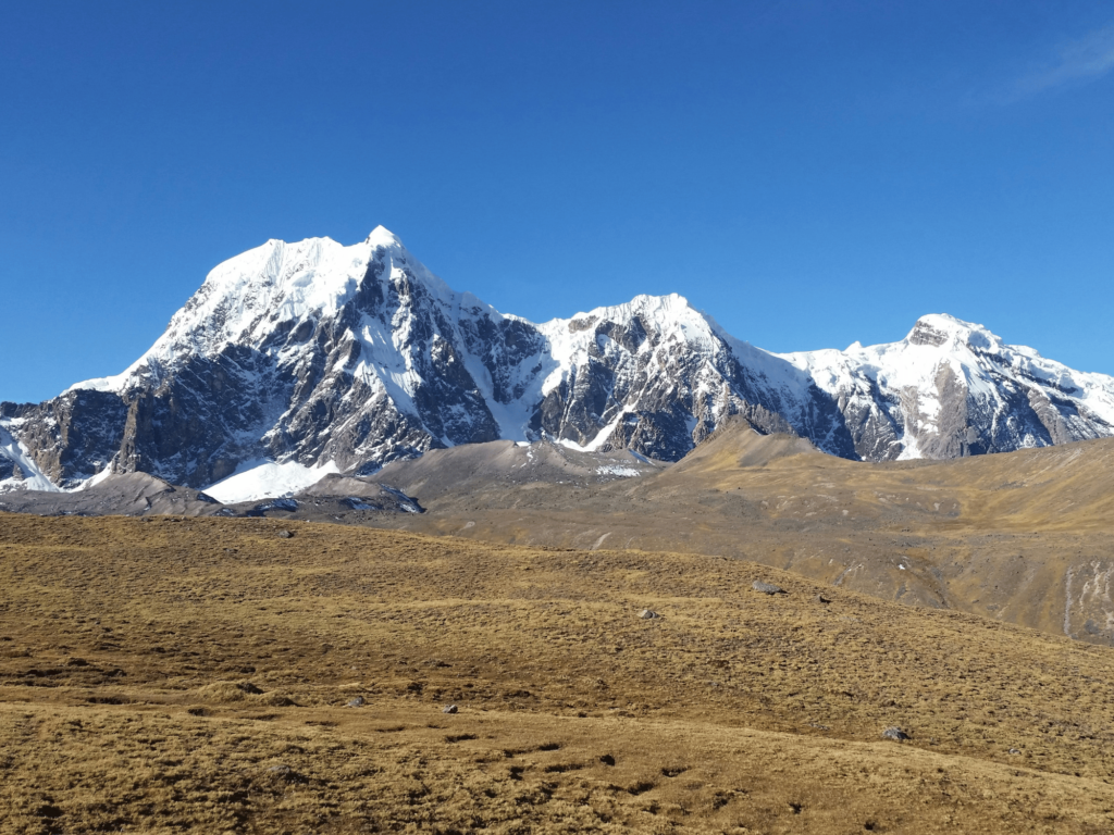
We’ll continue from Yanama through the valley towards the highest point of our tour, Paso Yanama (4,800 m / 15,748 ft). Along the way, we’ll enjoy a spectacular view of Sacsarayoc snow-capped peak and the chance to see condors soaring. At the pass, we might encounter snow, and the descent will be a long walk through grassy fields. On our way to the community of Totora, we’ll pass through areas with trees and cross small wooden bridges.
We’ll spend the night in Totora (3,700 m / 12,139 ft).
Key Information:
- Hiking distance: Approx. 15 km
- Hiking time: 7-8 hours
- Lowest Elevation: 3,700 m
- Highest Elevation: 4,800 m
- Difficulty level: Challenging
- Highlights: Views of Sacsarayoc, Paso Yanama, Andean landscapes.
As the climate and vegetation change, we’ll have the opportunity to observe a wide variety of birds, orchids, coffee plantations, and banana trees. La Playa is the largest village along the route where we will spend the night.
Key Information:
- Hiking distance: 15 km / 9.3 miles
- Hiking time: 7 hours
- Lowest Elevation: 2,320 m / 7,611 ft (La Playa)
- Highest Elevation: 4,800 m / 15,748 ft (highest point of the journey)
- Difficulty level: Demanding
- Highlights: Gentle ascent to the highest point, descent through changing vegetation, small waterfalls, diverse bird species, orchids, coffee and banana plantations, village of La Playa.
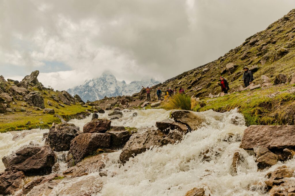
We’ll descend 200 meters through changing vegetation to a warmer campsite in the village of La Playa (2,320 m / 7,611 ft). This trek will take approximately 7 hours. Along the way, we’ll see small waterfalls where we can take refreshing baths. As the climate and vegetation change, we’ll have the opportunity to see a variety of birds and orchids. La Playa is the largest village on the trail, where we can see coffee and banana plantations.
Dinner and camping in La Playa.
Key Information:
- Hiking distance: Approx. 18 km
- Hiking time: 7-8 hours
- Lowest Elevation: 2,320 m
- Highest Elevation: 3,700 m
- Difficulty level: Moderate
- Highlights: Waterfalls, biodiversity, La Playa village.
Today, we’ll hike from the village of La Playa to the hydroelectric plant on the Urubamba River. In the morning, we’ll set off on a recently opened stretch of the Inca Trail. This trail was originally used for transporting agricultural products to Machu Picchu and will take us through areas with coffee plantations and subtropical fruit crops. Suddenly, we’ll enter a dense forest full of trees covered with thick moss. Here, we’ll get our first glimpse of the impressive Machu Picchu on a mountain across the valley. After a 10-minute walk, we’ll reach Llactapata for lunch and a refreshing break. From here, we’ll enjoy beautiful views of the mountains and Machu Picchu. Then, we’ll walk along the river to reach the Urubamba hydroelectric plant. Here, we can visit Intihuatana while we wait for the train to Aguas Calientes. Upon arrival in Aguas Calientes, we’ll be assisted to our selected hotel.
Key Information:
- Hiking distance: Approx. 15 km
- Hiking time: 6-7 hours
- Lowest Elevation: 2,160 m
- Highest Elevation: 2,650 m
- Difficulty level: Moderate
- Highlights: Llactapata ruins, views of Machu Picchu.
Today, we’ll take the bus from Aguas Calientes to the entrance of Machu Picchu. We’ll start our visit to the most important areas of the archaeological site, and our guide will explain the significance of this citadel as a religious and astronomical center. We’ll spend the rest of the day exploring this impressive site and have the opportunity to climb Huayna Picchu or visit the Temple of the Moon. After descending by bus to Aguas Calientes, we’ll have lunch. In the afternoon, we’ll take a train back to Ollantaytambo, where our driver will be waiting with a private vehicle to take us to your hotel in Cusco (arrival in the evening).
Key Information:
- Hiking distance: Minimal hiking, exploring Machu Picchu.
- Hiking time: Varied based on exploration.
- Lowest Elevation: 2,160 m
- Highest Elevation: 2,490 m
- Difficulty level: Easy
- Highlights: Machu Picchu citadel, optional climb to Huayna Picchu or visit to Temple of the Moon.
Note: This itinerary is subject to change based on weather conditions and group preferences.
Photo Gallery


What's Included?
Click on the tabs below to see what is included and what is not included as part of your trip. If there is something which is not mentioned here or your have any questions about what to bring, please get in contact with us on the contact page.
- Transfer in private transport from your hotel to Chinchero (starting point of the trek)
- Private transport from Lamay to Maras Moray, Salt Mine and Cusco
- Home stay or personal tents for 2 persons
- Dining tent with tables and chairs
- Professional bilingual guide (Spanish and English)
- Meals
- Cook and cooking equipment and kitchen tent
- Porters or horses (Carrying the tents, food and cooking equipment)
- Entrance fee to Huchuy Qosqo
- First-aid kit including emergency oxygen bottle
- Entrance to Maras Moray and Salt Mine and Chinchero
- Breakfast at the first and dinner at the last day
- Sleeping bag
- A small backpack to carry a light coat in case the weather changes during the trek.
- Appropriate rain gear (raincoat) and a rain poncho.
- In the large backpack carry warm overnight clothes.
- It is advisable to place all your clothes and sleeping bag inside plastic bags to prevent them from getting wet if it rains.
- Original passport.
- Sleeping bag, or you can rent them from us.
- Small towel.
- Trekking shoes, comfortable, it is recommended that they are waterproof.
- Sandals/ flip-flops
- Hats for sunny and cold weather.
- Sun block and moisturizing cream & after sun.
- Insect repellent (minimum 20%).
- Flashlight, camera, camcorder and batteries (with the cold weather they are consumed quickly).
- Toilet paper, wet wipes.
- Personal first aid kit.
- Snacks (energy bars, dried fruit, chocolates, cookies, etc.).
- 2 x 600 ml water bottles. You can refill it with boiled water during the trekking.
- Cash in soles and dollars.
- Hiking poles (recommended) or you can rent them from us.
- Pants
- Socks, polo shirts
- Underwear shorts
- Sweater, jacket.
- Towel, bathing clothes.
- Hat, scarf, sunglasses.
FAQs
We recommend that you pack with care when preparing to embark on this magical trek. The weather in the Andes can be extremely changeable so we recommend:
- Hiking boots. Make sure that these are comfortable enough and they give you appropriate support as you will be walking for several days. The last thing you want to ruin your trek is blisters or foot sores!
- Warm clothing. The Andes often drops below freezing at night due to the fact that you are at high altitude. Make sure that you bring hats, gloves, scarfs and warm apparel with you to guard against the cold.
- Waterproofs. We recommend bringing water protective wear which is both light and insulated. Depending on the season, you might want to bring a light waterproof in the dry season, whilst a heavier waterproof for the rainy-season. Check with your guide if you are unsure on what to bring.
- Small rucksack. This smaller rucksack is for travelling during the day. Your guide will ensure that your larger bags and heavier equipment which you do not require for hiking is taken on horseback to the next stop ahead of you so you have it at the end of each day.
- Altitude sickness tablets. We always recommend bringing altitude sickness tablets with you when travelling to places which are often hundreds of metres about sea-level.
- Torch or flashlight. We recommend bringing a torch with you so that you are able to see where you are going at night. It’s not a good idea to fumble around in the dark without seeing where you are going!
We understand that sometimes your plans may change due to unforeseen circumstances. If you make a booking but then wish to cancel it, the following cancellation policies apply:
[Insert Cancellation Policy Table here]
Yes. We always recommend that you take out an insurance policy before travelling. We do not cover you on our insurance policy and we require you to sign a waiver prior to travelling for any damages, injuries etc that may occur on your trip.
However, you can rest assured in the knowledge that our experienced guides will ensure that you have a safe and enjoyable trip.
